
Distance. In the United States we typically measure it in terms of feet, yards, miles, etc. Most of the rest of the world uses meters and kilometers (KMs), referred to as the Metric System. One of the exceptions in the United States is large segments of the scientific world. For example, a scientific field in which I am an avocationalist is archaeology. Everytime we measure a site, or we record distances hiked, we use the metric system.
We recently documented a prehistoric site on the Agua National Monument. It was comprised of two habitation structures, nine grinding slicks, 30 Petroglyph boulders and several hundred artifacts like pottery sherds, lithic debitage, metates and manos. The site itself was over 100 meters long and 30 meters wide oriented on a NW/SE axis. It was located 2.1 KMs north of another well known reference point. (I’ve described it this way to avoid telling anyone exactly where it was located.)
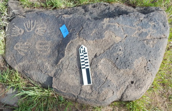
One of the thirty Petroglyph boulders
Within the site the two habitation structures were located about sixty meters apart and the wall fall from each of the structures covered an area about 6 x 8 meters in size. The two major artifact scatters around the structures were around 25 to 30 meters in diameter. The individual pottery sherds probably averaged 3 to 5 centimeters in size.
My walks on the monument have all be recorded in KMs. So far I have walked around 1,700 KMs – mostly in wandering patterns much like the trail of an ant would create. I think the amount I’ve walked would have covered the distance from Phoenix to north of the Golden Gate Bridge in California. Impressive, but when you break it down into almost 400 walks or hikes over a dozen years, it really isn’t.

View looking south across a portion of the Agua Fria National Monument
That gives you an idea of measuring distance on several different scales and with several methods. And it completes my short blog for the day.
